

Commercial · Texas and Oklahoma

Commercial Earthwork Services Across Texas and Oklahoma

Commercial construction starts on a site that is ready for every trade after it. IRONWILL Earthworks clears, grades, builds the pads and prepares the paving subgrade for office, retail, medical, hospitality and mixed-use projects across Texas and Oklahoma, and we hand over a definition of pad-ready that the surveyor and the testing laboratory have already signed.

Office & retail
Medical & hospitality
Mixed-use
Business parks
Pad-ready sites
Dallas-based crews

Mobilized across the metroplex in a day

Built for who follows

Pads and subgrade the next trade does not rework

Developer and GC fluent

Submittals, third-party tests, weekly look-ahead

One contractor, whole site

Clearing through final grade on one schedule

Why it matters

Site work sets the schedule for every trade that follows

North Texas is adding people and buildings faster than almost anywhere in the country. Between July 2023 and July 2024 Fort Worth grew by 23,442 residents and crossed one million, Dallas added 22,164, Princeton grew 30.6 percent in a single year, Celina grew 18.2 percent to 51,661, and Collin County added about 18,000 housing units1. Each of those people needs a grocery store, a clinic, an office and somewhere to eat, and each of those buildings needs a pad. Commercial site work in this region is the first scope on a very long list of projects that all want the same crews at the same time.

Earthwork is the one scope every other trade inherits. Concrete is poured on the pad we built. Storm and sanitary lines are laid to depths measured from the grade we set. Paving goes down on the subgrade we conditioned and the base we placed. When site work is late or out of tolerance the cost is paid again by everyone behind it, and on a commercial program the date that moves is the certificate of occupancy, which is the date the lease starts paying.

So we treat pad-ready as a defined condition with a test behind every line of the definition, not as a date on a schedule. The definition is written out further down this page.

Scope

Every earthwork scope a commercial site needs, under one contract

Commercial sites bring occupied neighbors, public street tie-ins, tight access and a program that was sold to a tenant before the geotechnical report was written. These are the services we bring to them, in whatever combination the site, the report and the program call for.

The county soil survey10, the FEMA flood map11 and the geotechnical borings read together before the bid, so the takeoff is built on the ground that is there.

Protected trees fenced at the drip line where the city's ordinance requires it, everything else cleared, ground on site and hauled.

Removal of the buildings, slabs and paving of a former use, with the utility locates, the survey and the notices done before the machine swings.

Cut and fill balanced across the site so the pads, parking fields and detention are shaped from the site's own material, with the detention drawn to the region's iSWM criteria3.

Undercut, moisture conditioning, treatment and select fill to the geotechnical report, proven lift by lift before the foundation contractor arrives.

Subgrade and flexible base under drive aisles, fire lanes and parking, graded so the finished accessible routes meet 1:20 running slope and 1:48 cross slope2.

Support for excavations beside occupied buildings, walls and streets, engineered wherever an adjoining structure would otherwise be endangered12.

The SWP3 in place before the first acre is opened, controls maintained and inspections logged through the job4.

Look-ahead schedules, submittals, testing coordination and the daily record the GC's superintendent works from.

Each scope also covers what never gets a page of its own: storm drainage structures and their backfill, rough and final grading, stabilization, import and export of material, and the approaches that tie the site into the public street. It is sequenced as one site preparation package, so there is no seam between subcontractors for the schedule to fall through.

What you get

What pad-ready means when we say it

Pad-ready is used loosely on a lot of schedules. We use it to mean a set of conditions, each with a test behind it, so the foundation contractor, the paving contractor and the owner's inspector are holding the same definition. The laboratory compaction curve comes from ASTM D698, which relates molding water content to dry unit weight under a standard effort of 12,400 foot-pounds per cubic foot and fixes the optimum water content and maximum dry unit weight that every field test is measured against7. The field test is a nuclear gauge to ASTM D6938, which reads density and water content to a depth of twelve inches, with direct transmission the preferred method8, or Tex-115-E where the specification names it, at locations chosen at random rather than where the ground looks best9.

Here is the definition, deliverable by deliverable.

Pad-ready, deliverable by deliverable: what each condition means and how it is proven before handover.
DeliverableWhat done meansHow it is proven
Pad elevation and extentThe pad is at plan elevation within the tolerance on the drawings, over the footprint plus the overbuild the geotechnical report specifiesSurveyor's as-built shots against the design model
Subgrade materialUnsuitable material is undercut and replaced or treated as the report directs, to the depth it namesUndercut depths logged; laboratory classification of what went back
CompactionEvery lift of fill reaches the percentage of maximum dry density the report setsThe laboratory curve to ASTM D6987; in-place tests by nuclear gauge to ASTM D69388 or Tex-115-E9, at random locations
MoistureEach lift is inside the report's window relative to optimum; on expansive clay that is at or above optimumWater content reported with every density test8
Swell controlThe treatment the report specified against its potential vertical rise estimate is in place, at the depth it namedThe report's Tex-124-E estimate6; treatment depth and material logged
DrainageWater leaves the pad and every paved area by the path on the drainage plan; nothing pondsSurveyor's flow line shots; walked after the first rain
Stormwater controlsThe SWP3 is in place and maintained, with the inspection log currentThe TCEQ construction general permit4
Accessible route subgradePaving subgrade is graded so finished accessible routes will not exceed 1:20 running slope and 1:48 cross slope, and accessible parking will not exceed 1:48 in any direction2010 ADA Standards, Sections 403.3 and 502.42; surveyor's shots

Pad elevation and extent shot by the surveyor against the model

Schedule built backward from the slab date, with float where the weather goes

GPS-guided equipment, with grade checked against the design surface

Utility locates, daily competent-person inspections, a site left safe each evening

Weekly look-ahead shared with the GC and the design team

Density, moisture and elevation results delivered with the pad, not after it

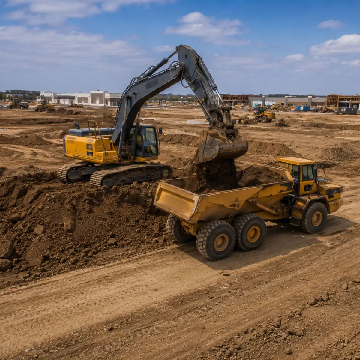
Excavator loading an articulated haul truck on a commercial site
Who we build for

Commercial projects we support

We prepare sites for commercial development of every size across Texas and Oklahoma, from a single restaurant pad on an outparcel to a multi-building business park delivered in phases.

Office buildings
Retail centers
Shopping centers
Restaurants
Medical offices
Healthcare facilities
Hotels
Warehouses
Distribution centers
Industrial facilities
Mixed-use developments
Business parks

No two of them sit on the same ground, even when they share a soil name. Much of the region is high-plasticity clay like the Blackland Prairie's Houston Black, 40 to 60 percent clay with high shrink-swell potential that opens cracks half an inch to four inches wide a foot below the surface in a dry spell5, but what a given site will do is in its geotechnical report and boring logs. The report expresses what the ground will do to a slab as potential vertical rise, an estimate in inches of how much the soil below a foundation or a pavement can swell when it takes on water6, and the pad treatment is what brings that number down.

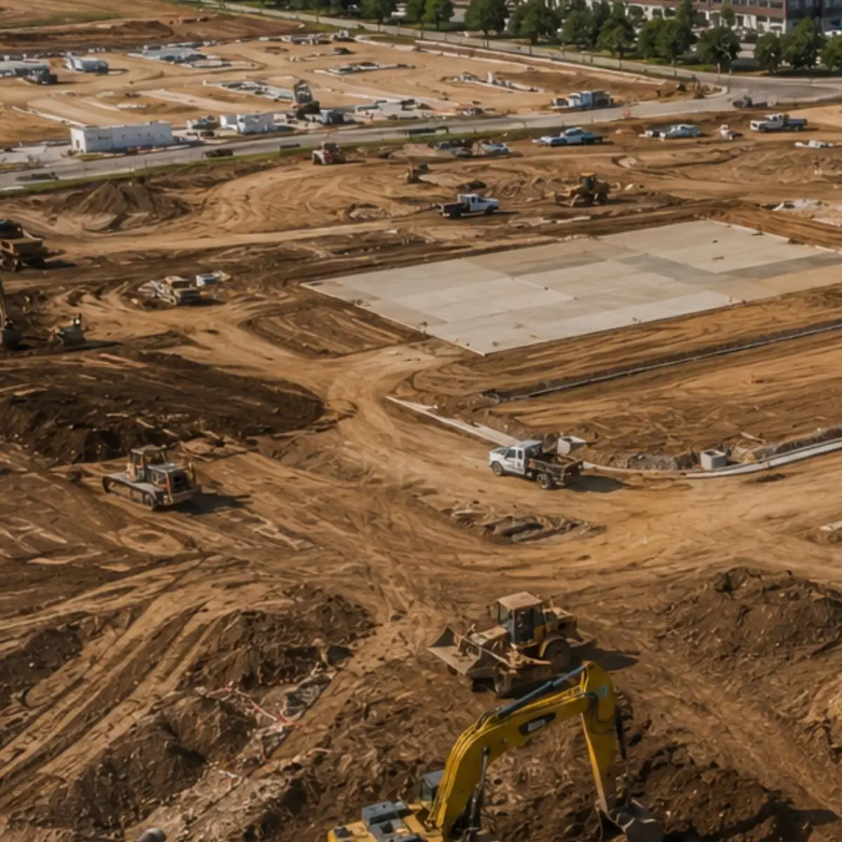
Aerial view of building pads and roads taking shape on a commercial development

Breaking ground on a commercial project?

Send the civil plans, the geotechnical report and your target date for the slab. We will come back with a scope, a schedule built backward from that date, and an honest read on what the site is going to do.

Service area

Commercial site work across Texas and Oklahoma, from Dallas-Fort Worth

We prepare commercial sites throughout the metroplex and the counties around it, and across Texas and Oklahoma beyond them. Crews and equipment are based in Dallas. Around the metroplex the stormwater criteria are the same iSWM program that more than 60 local governments cooperate in3 and the weather windows are the same short ones; the ground is different on every site, and its report says how.

If the development is in Texas or Oklahoma, ask. The metroplex and the counties touching it are the footprint we bid every week.

Dallas
Fort Worth
Plano
McKinney
Frisco
Allen
Lucas
Melissa
Richardson
Carrollton
Lewisville
Denton
The Colony
Prosper
Celina
Little Elm
Rockwall
Garland
Mesquite
Arlington
Grapevine
Flower Mound
Irving
Weatherford
Kaufman
Waxahachie
Wylie
Sherman
Greenville
Collin County
Send with your inquiry
→

Site address and total acreage

→

Civil plans and geotechnical report

→

Building footprint and pad count

→

Required paving section

→

Target date to turn over pad-ready

FAQ

Commercial earthwork FAQ

What types of commercial projects does IRONWILL Earthworks support?

Office buildings, retail and shopping centers, restaurants and outparcels, medical offices and healthcare facilities, hotels, mixed-use developments and business parks across Texas and Oklahoma, for developers, general contractors and owners.

Do you provide complete commercial site preparation?

Yes, as one scope: clearing, selective demolition, excavation, mass grading, pad preparation, paving subgrade and flexible base, storm drainage, erosion control and final grading. One contract means one schedule, one superintendent to call, and no seam between subcontractors where responsibility gets lost.

Do you work directly with developers and general contractors?

Regularly, and with their engineers. We are used to the coordination that comes with commercial work: submittals, preconstruction meetings, third-party testing, city inspections and a weekly look-ahead.

How does clay affect a commercial site?

It decides the section, and the geotechnical report decides how. On clay like Houston Black, 40 to 60 percent clay with high shrink-swell potential5, the report and its boring logs set the undercut depth, whether the subgrade is treated, how much select fill goes on and what moisture the pad is held at. The report's potential vertical rise figure is the number the pad design is working against6.

Can you keep an occupied property operating during construction?

Yes, and on retail and medical work it is the normal case. Phased grading, maintained fire lanes and accessible routes, dust and traffic control, and staging that keeps the working area separate from the operating one are planned before mobilization. Where an excavation could endanger an adjoining building or wall, support is engineered and installed before the cut is made12.

What areas do you serve?

Commercial construction across Texas and Oklahoma from our Dallas base, including Dallas, Fort Worth, Plano, Frisco, McKinney, Allen, Prosper, Celina, Denton, Sherman, Greenville and the surrounding communities.

Sources

Every number and every rule on this page is cited here. Reviewed September 17, 2026.

  1. Fastest-Growing Cities Are Increasingly in the South and West (Vintage 2024 Population Estimates)U.S. Census Bureau, 2025The July 2023 to July 2024 gains for Fort Worth, Dallas, Princeton and Celina, and Collin County's housing unit gain.
  2. 2010 ADA Standards for Accessible DesignU.S. Department of Justice, Civil Rights Division, 2010Section 403.3, running slope not steeper than 1:20 and cross slope not steeper than 1:48 on accessible routes; Section 502.4, accessible parking and access aisles not exceeding 1:48 in all directions.
  3. Integrated Stormwater Management (iSWM) Program for Construction and DevelopmentNorth Central Texas Council of GovernmentsThe regional stormwater criteria more than 60 local governments cooperate in, covering both construction and post-construction obligations.
  4. Stormwater General Permit for Construction Activities (TPDES General Permit TXR150000)Texas Commission on Environmental QualityThe SWP3 required before construction begins, the one acre and five acre thresholds, and the Notice of Intent.
  5. Official Series Description: Houston BlackUSDA Natural Resources Conservation ServiceClay content of 40 to 60 percent, high shrink-swell potential, cracks 1/2 to 4 inches wide at a 12 inch depth in dry periods, and the Blackland Prairie setting.
  6. Tex-124-E, Potential Vertical Rise of Natural Subgrade SoilsTexas Department of Transportation, Materials and Tests Division, 2017The definition of potential vertical rise, in inches, for the soil below a pavement, bridge or building foundation.
  7. ASTM D698, Standard Test Methods for Laboratory Compaction Characteristics of Soil Using Standard Effort (12,400 ft-lbf/ft3)ASTM InternationalThe compaction curve, optimum water content and maximum dry unit weight that field density is measured against.
  8. ASTM D6938, Standard Test Methods for In-Place Density and Water Content of Soil and Soil-Aggregate by Nuclear Methods (Shallow Depth)ASTM InternationalThe nuclear gauge test to twelve inches, direct transmission preferred, used for acceptance of compacted fill.
  9. Tex-115-E, Measuring In-Place Density and Moisture Content of Soils and Base MaterialsTexas Department of Transportation, Materials and Tests Division, 2025The in-place density test and its Part IV, random selection of test locations.
  10. Web Soil SurveyUSDA Natural Resources Conservation ServiceThe National Cooperative Soil Survey data for any site, covering more than 95 percent of the nation's counties.
  11. FEMA Flood Map Service CenterFederal Emergency Management AgencyThe official public source for flood hazard information under the National Flood Insurance Program, searched by address.
  12. 29 CFR 1926.651, Specific Excavation RequirementsCode of Federal Regulations, U.S. Government Publishing Office, 2023Paragraph (b), utility locations determined before an excavation is opened; paragraph (i), support systems where adjoining structures are endangered; paragraph (k), daily inspection by a competent person.